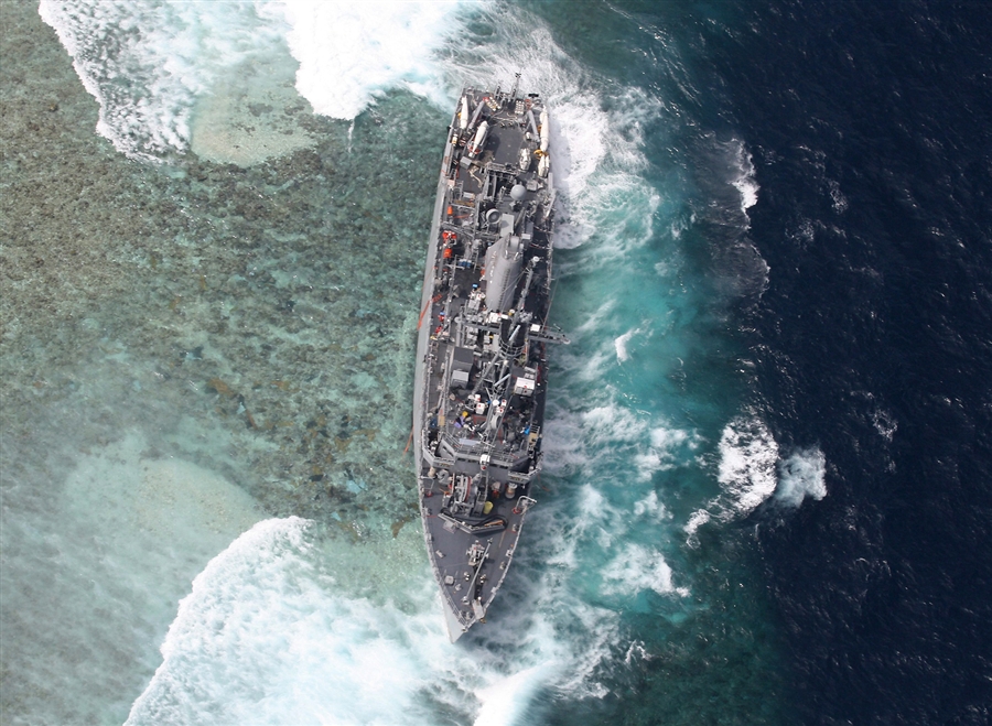
It’s hard to know where to start with this one except to say that this lesson has been learned before. This crew had, of course, electronic navigation aids out the wazoo and also had paper charts for the area, which, if used, would have prevented this “you’ve got to be kidding me” accident.
According to the story I read in Passagemaker magazine, “A Navy investigation found that the digital chart in use at the time incorrectly listed the reef’s location by eight miles.” Oops. But, “In the case of the Tubbataha Reef, the Guardian’s paper charts had the correct position…”
